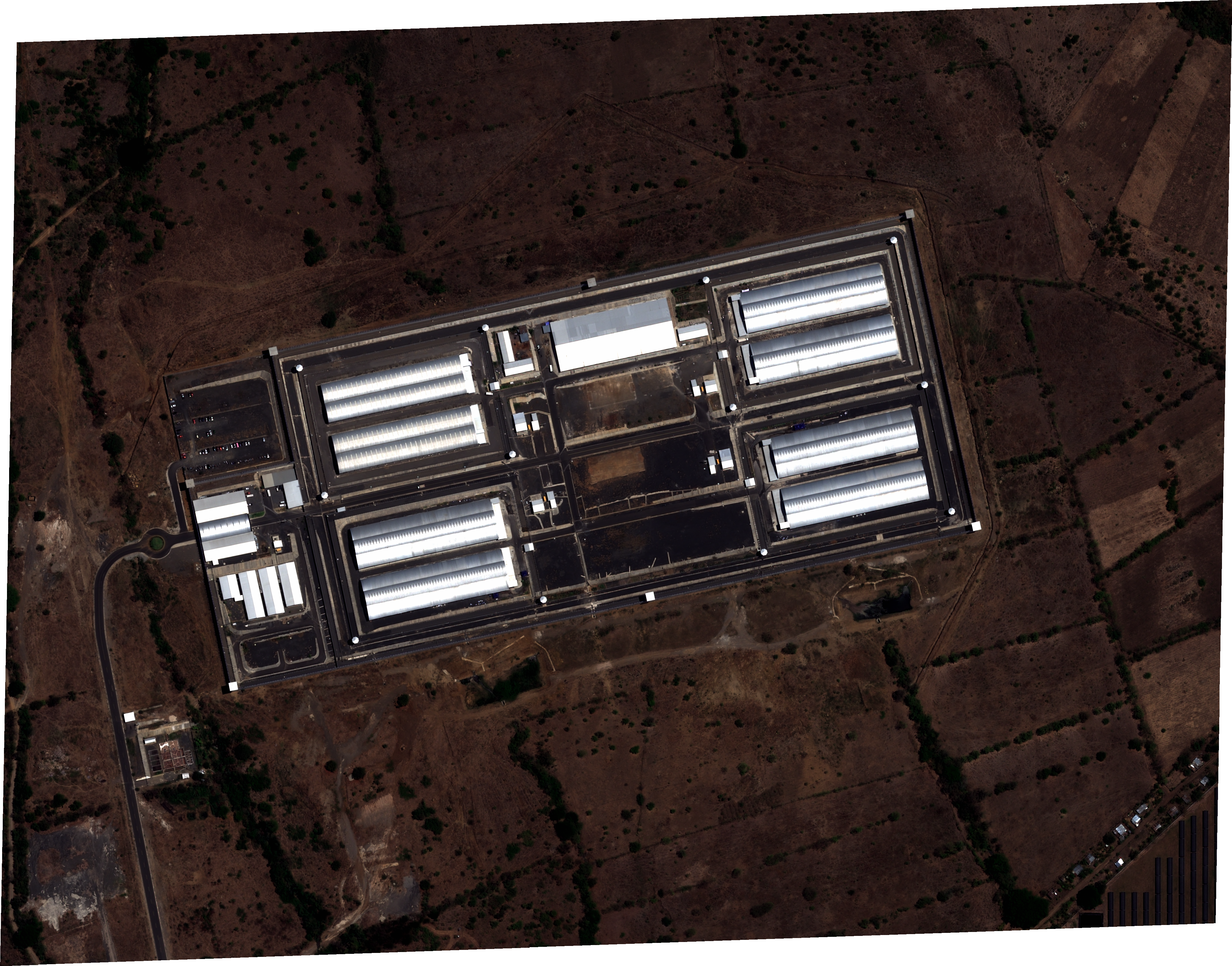
Related: I recently completed an initial spectral analysis of the March 20, 2024 imaging.
Update 1: We've identified Maxar 15cm (Very High Res) imagery from Feb. 22, 2024, but it does NOT include the CECOT facility… if anyone can point us in the right direction to get this higher-res imagery, please comment below!

Update 2: I obtained imagery from March 20, 2024. Same satellite, same resolution as below.
If you (like many) are interested in what is going on at CECOT, here’s something to further your investigation.
I have purchased Pleiades-Neo satellite imagery from SkyWatch. The resolution is 30cm and the capture date is April 14, 2025.
Original Image (TIF) - Note that this is a Cloud-Optimized GeoTIFF (COG) that will not open in Google Earth or Photoshop. You will need a compatible tool to view this high-res image.
Anything interesting? Perhaps we can use this as a central place to share our findings.
I am concerned about the small round building slightly northwest of the main facility visible on Google Earth. It's not in your pictures because it's a little too far away from the main facility. It looks like a partially underground structure and seems to have a round hole or chimney in the roof. It's connected to CECOT by the roadways and looks like it may be part of the facility.
The specific coordinates are 13.537686, -88.810061
If you are using Skywatch there is Pleiades-Neo-HD15 15cm resolution for April 14th, March 19th, and March 11th 2025. There are earlier dates available for this source but they predate the construction of the facility. I would take a look at your filters. If your sort by highest price first these will show up as they are $40 per sqkm or $1000 minimum purchase.
As for the Maxar I do not beleive they have done any 15cm collection in the area of interest before they have built the facility.